Sierra Railroad 1955
Layout Diagrams
The map below is of the prototype Sierra Railroad and its connecting railroads. The orientation of the map as well as the layout is that you are standing on the North side of the tracks looking South, East is to your left and West to your right.
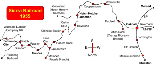
The only fictitious location on the layout is Meinke Jct on the SP Branch. Meinke Jct is named for my grandparents and represents a typical Valley town served by the SP.
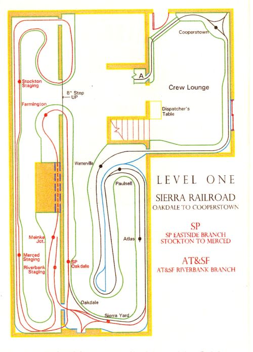 Level One , the Sierra trackage is in black. Oakdale to east of Cooperstown. The diagram does not show the detailed track arrangements at each town/location. Check the Layout Photos page to see the actual track configuration.
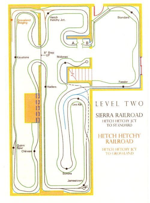
Level Two, Sierra mainline from just west of Hetch Hetchy Junction to just east of Standard. This diagram also show the Hetch Hetchy Railroad wye at the Junction and the staging track for the HH Railroad. The Sierra Mainline runs behind the Jamestown turntable up the hill to Lime Kiln. The track closest to aisle becomes the Angels Branch to Melones.
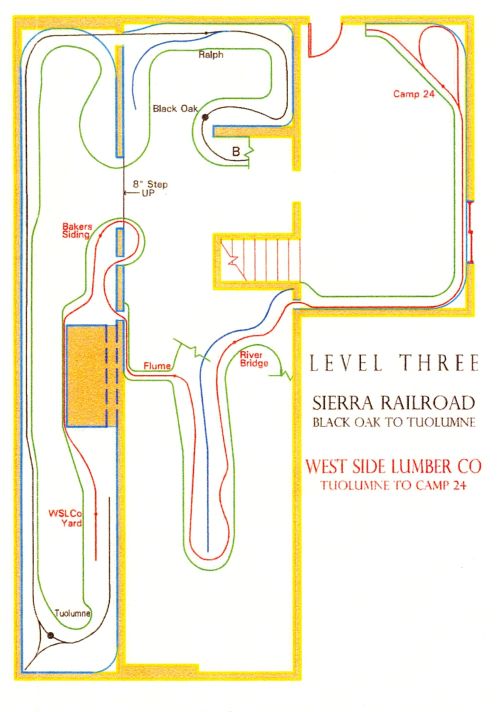 Level Three, Sierra mainline from just west of Black Oak to the wye at Tuolumne. Also shown on this level is the WSLCo trackage. WSLCo trains now run from Tuolume out to Camp 24 and back to Tuolumne. Like the prototype empty Log cars are sent out to Camp 24 and exchanged for loaded Log cars for the mill in Tuolumne.
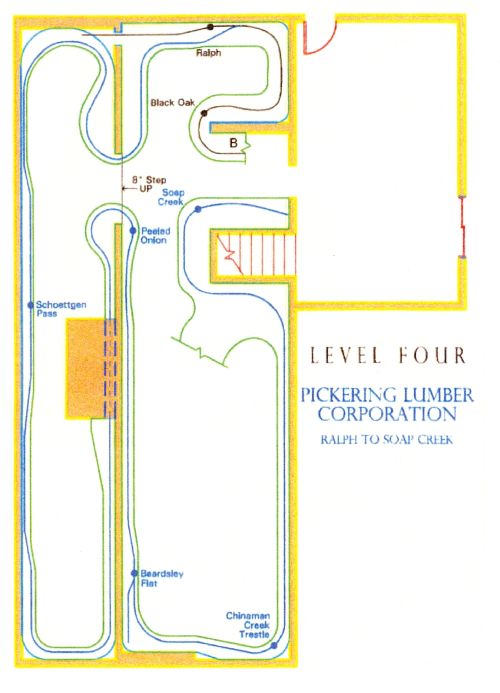 Level Four, shows the Pickering Railroad trackage from Ralph to Soap Creek. A loaded log train, 16 log cars and two Shays leaves Soap Creek and at Beardsley Flat drops half of its loads on the spur. With two shays and eight loaded log cars it’s still a hard pull up the Peeled Onion and then onto Schoettgen Pass. At Schoettgen Pass the Woods train exchanges its loads for empties with the Mill train.
Railroad Pages
- Welcome
- About the Layout
- What's New
- Operations Overview
- Photos
- Prototype Track Drawings
- Contact/Location
- Research Sources
- Sierra Railroad Op Session Calendar
Sierra Historical & Modeling Seminar
Recent Posts
Post Archives
- August 2007 (1)
- May 2007 (1)
Post Categories
- Announcements (2)
Historical Groups
Model Mfgs
Operations
Other Layout Links
Other Sites
Meta
copyright © 2007-2026 John Zach -- WP-Design: Vlad -- Powered by WordPress -- site by webdancers